11311133 COMMONWEALTH AV
Owner Information
COMMONWEALTH ELEVEN 37
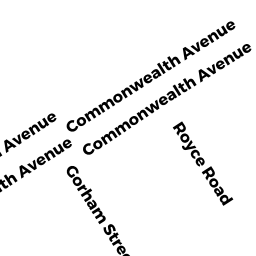
39 BRIGHTON AV
ALLSTON, MA 02134


Property Details
11311133 COMMONWEALTH AV is classified as a Apartments with More than Eight Units (Apt 7-30 units).
The primary structure on this property was built in 1920. There are 24,800ft2 of built area within this property. There is 19,840ft2 of residential/living space within this property.
11311133 COMMONWEALTH AV is valued at $5,273,100. The land is valued at $2,354,600 and the structures are valued at $2,918,500.
The most recent deed for 11311133 COMMONWEALTH AV is recorded at the local registrar in Book 19837, Page 218. 11311133 COMMONWEALTH AV was last sold on Tuesday, June 27, 1995 for $1,710,000.
Assessment data from fiscal year 2020.
Flood Data
According to the FEMA National Flood Hazard Layer, this property does not appear to be in a flood zone. It may also be in an area not yet reviewed. Nonetheless, confirm this information prior to taking any action.
To view the flood hazards around this property, create a FEMA "Firmette" Map of the area around 11311133 COMMONWEALTH AV.
Broadband Internet Providers
| Provider | Type | Bandwidth (mbps) | |
|---|---|---|---|
| Verizon New England Inc. | Fiber | 940 | 880 |
| GCI Communication Corp. | Satellite | 0 | 0 |
| netBlazr Inc | Fixed Wireless | 50 | 50 |
| Comcast | Cable | 1000 | 35 |
| Viasat Inc | Satellite | 100 | 3 |
| VSAT Systems, LLC. | Satellite | 2 | 1 |
| HughesNet | Satellite | 25 | 3 |
| Crown Castle Fiber | Fiber | 0 | 0 |
| Starry, Inc. | Fixed Wireless | 200 | 200 |
| Verizon New England Inc. | DSL | 10 | 1 |
Broadband service provider data from December 2020.
Adjacent Properties
- 1127 COMMONWEALTH AV
Mixed Use (Primarily Residential, some Commercial) owned by PETERSON RUSSELL L TRSTS - 18 ST LUKES RD
Three-Family Residential owned by YEE STEPHEN S - 20 ST LUKES RD
Three-Family Residential owned by LONG BAILEY W - 11351137 COMMONWEALTH AV
Apartments with More than Eight Units owned by COMMONWEALTH ELEVEN 37